Category: Public information. Tags: Wayfinding and directories, Lobbies and reception, Healthcare, Schools and campuses, Offices and workplaces, Transit and travel.
Previews
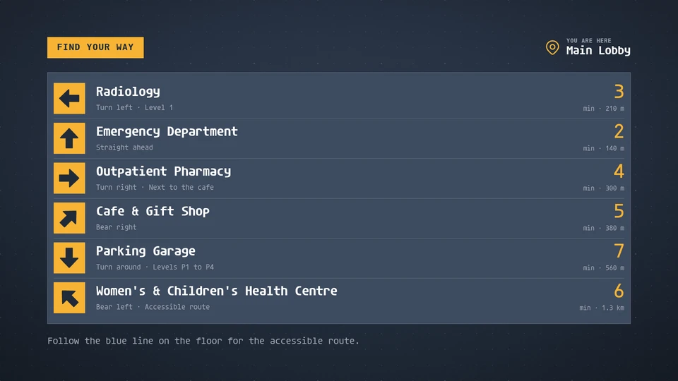
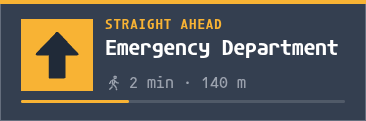

Views and forms
Views: canvas, corner, chip. Canvas forms: landscape, portrait, square, strip.
Card views, themes and publishing. Browse the gallery.
Data and privacy
This card uses its configured properties and live card data.
Properties
For theme, background, accent and position, see Common properties.
Set static properties in params. Bind data to a project card data key for live values; that document holds only dynamic properties. Without a data key, put the complete configuration in params. Nested rows describe the contents of their parent property.
Static properties
| Name | Type | Default | Values and limits | Description |
|---|---|---|---|---|
title | string | "Find your way" | maxLength: 40 | |
here | string | "" | maxLength: 40 | Where this screen stands, shown as "You are here". Empty hides it. |
order | string | "listed" | "listed", "time", "name" | listed: as given. time: nearest first. name: A to Z. |
Dynamic properties
| Name | Type | Default | Values and limits | Description |
|---|---|---|---|---|
destinations | array | [] | minItems: 0; maxItems: 8 | |
destinations[].name | string | minLength: 1; maxLength: 40; Required | ||
destinations[].direction | string | "ahead" | "ahead", "ahead-right", "right", "back-right", "back", "back-left", "left", "ahead-left" | Which way to go from this screen; the arrow points that way, "ahead" is up. |
destinations[].minutes | integer | minimum: 1; maximum: 120 | Walking time in minutes. Left out, it comes from "meters" at 80 m a minute. | |
destinations[].meters | integer | minimum: 1; maximum: 99999 | Walking distance in meters, shown under the time. | |
destinations[].detail | string | "" | maxLength: 40 | A note after the direction: a level, a landmark, an accessible route. |
footnote | string | "" | maxLength: 120 |
Canvas example
Add this item to a playlist page’s primitives. Publish the playlist and assign a screen.
{
  "id": "wayfinding",
  "primitive": "card",
  "card": "wayfinding",
  "major": 1,
  "params": {
    "theme": "neomustard"
  },
  "rect": {
    "x": 0,
    "y": 0,
    "width": 1920,
    "height": 1080
  },
  "layer": 0,
  "content_fit": "fill",
  "data": "wayfinding-main"
}
Write live data
Create this document before showing the card, then replace it to update the screen without republishing. Use the same project as the playlist. Supply your API authorization through the environment; see API authentication.
curl --request PUT "https://api.screenrig.ai/api/card-data/wayfinding-main" \
  --header "Authorization: Bearer $SCREENRIG_TOKEN" \
  --header "ScreenRig-Project: $SCREENRIG_PROJECT" \
  --header "Content-Type: application/json" \
  --data '{"document":{"destinations":[],"footnote":""}}'